

Calgary River Valleys Project
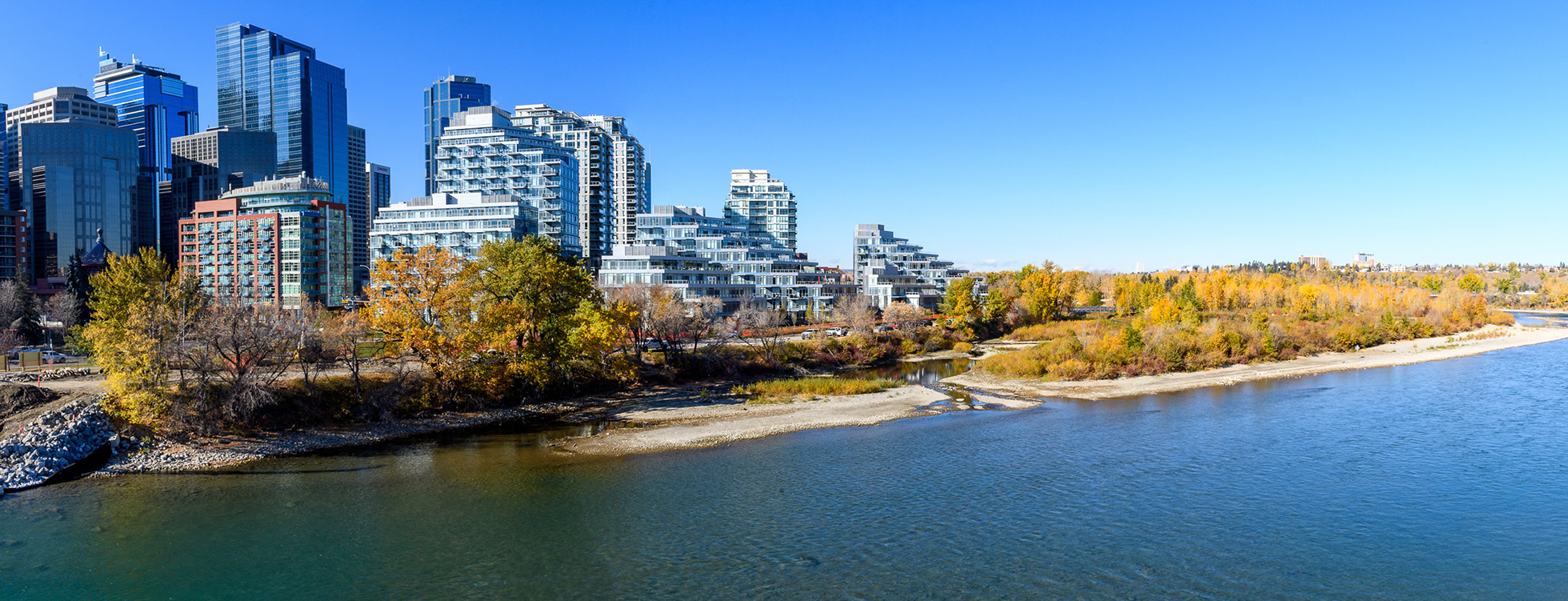
Calgary River Valleys Project
Planning the future of Calgary’s river valley areas to support resilient river communities
The river valleys are essential to Calgary’s identity. They play an important role in our city’s appeal as one of the best places in the world to live, play and do business.
Making careful decisions about how we plan, develop and build in the floodplain is a fundamental part of protecting and enhancing resilient river communities.
Public engagement now open
We are hosting a fourth round of public engagement from September 28 to October 11, 2026, with a focus on High Hazard Flood Fringe and Groundwater Flood Fringe communities.
It will be an opportunity to strengthen shared understanding of flood risk and resilience measures and consider if further changes should be made to Administration’s recommendations prior to presenting to Committee in early 2027.
Project update
Thanks to critical investments in flood mitigation, Calgary’s flood damage potential of a 1:100 flood has been reduced by 70 per cent. Although this means our city is more flood resilient than ever, our river communities remain vulnerable to varying degrees of flooding. Development regulations in flood hazard areas remain essential to ensure safety and address residual risks, including groundwater impacts during river floods. Through the Calgary River Valleys Project (CRVP), we’re working to update Calgary’s Land Use Bylaw to reflect updated floodplain mapping and regulations.
Update on Flood Resilience Land Use Bylaw Amendments
The City is continuing work on the Flood Resilience Land Use Bylaw Amendments as part of the Calgary River Valleys Project.
Following consideration by the Infrastructure and Planning Committee on April 15, 2026, and Council direction on April 28, 2026, the report has been referred back to Administration for additional engagement with affected communities - particularly those in high hazard flood fringe and groundwater flood fringe areas.
We are now conducting additional community engagement September 28 – October 11, 2026. This phase of work will focus on:
- Engagement with High Hazard Flood Fringe and Groundwater Flood Fringe communities.
- Strengthening shared understanding of flood risk and resilience measures.
- Considering if further changes should be made to Administration’s recommendations prior to presenting to Committee in early 2027.
Until the new maps and regulations are finalized and City of Calgary policies and bylaws have been updated, development applications will continue to be assessed under the current Land Use Bylaw.
However, we’ll continue to share the best available flood risk information with development applicants and others to provide advisory comments for further resilience, or to permit relaxations as appropriate, just as we’ve done since 2013.
What is the Calgary River Valleys Project?
The City is planning for the future of our river valleys through the Calgary River Valleys Project.
The purpose of the Calgary River Valleys Project is to provide guidance for decisions about how we plan, use, conserve and build in our river valleys. The goal is to create coordinated and purposeful land use policies. These policies may make use of a range of levers, including reserves, setbacks, densities and different types of land uses.
The project will inform amendments to the Municipal Development (Calgary) Plan and Land Use (Zoning) Bylaw, ensuring that Calgary’s guiding documents consistently address development, planning and investment in our river valleys and areas impacted by flooding.
Why this project is important
Calgary’s river valleys are essential to our city—they are part of Calgary’s origin story, are woven into our place names and are a key part of The City’s visual landscape and wayfinding system. They are a place of vibrant communities, our downtown core, parks and abundant wildlife.
The decisions we make today about the river valleys will have long-term impacts. It’s important to articulate smart, long-term priorities for land use, conservation, planning and investment.
Bold actions now will determine future climate change and flood resilience and the well-being of Calgary’s environment, communities and citizens.
Learn more about the different roles the river valleys play in Calgary:
Nature
Nature
Nature
River valleys contain important natural and ecological systems. They provide a range of high-value ecological goods and services, including functions that relate to provision, habitat, and regulation. They supply Calgary with high quality drinking water and provide natural infrastructure that helps us manage stormwater, wastewater, and our relationship to local wildlife.
Recreation & Access
Recreation & Access
Recreation & Access
River valleys are important recreation spaces. They anchor Calgary’s park system, which provides a wide range of spaces for both active and passive recreational use. The rivers are home to water sports, fishing and swimming and the valleys contain important parks and pathways that tie together The City’s active transportation network.
Culture
Culture
Culture
River valleys are important cultural landscapes with deep histories.
Calgary’s river valleys contain deep histories of meaning and use that span thousands of years of inhabitation and include sacred Indigenous places.
Today, they continue to provide a setting for cultural expression, reflection, spirituality and celebration for many different individuals and groups.
Building & Development
Building & Development
Building & Development
River valleys are attractive places to live and work. They bring value through proximity to water and green space, and continue to draw a range of land uses that seek to leverage this value.
Flooding
Flooding
Flooding
River valleys are prone to flooding. Floods are a natural occurrence, but they are increasing in number and severity, due to a changing climate. This trend presents more risks to safety and property in the city. The City has a responsibility to address flooding through both emergency response and risk reduction, which includes setting out appropriate land use profiles for the river valleys.
Project engagement
A multi-staged public engagement process began in April 2023 to collect input from people who live, work, travel and play within Calgary’s river valleys.
Stage 4 - September 28 to October 11, 2026
We will be conducting aAdditional community engagement is open from September 28 to October 11, 2026. This phase of work will focuses on:
- Engagement with High Hazard Flood Fringe and Groundwater Flood Fringe communities.
- Strengthening shared understanding of flood risk and resilience measures.
- Considering if further changes should be made to Administration’s recommendations prior to presenting to Committee in early 2027.
Previous engagements
Stage 3 (Nov. 24 – Dec. 12, 2025)
In Stage 3 engagement, November 24 to December 12, 2025, we presented draft updated development regulations for our flood hazard areas that will be incorporated into the Land Use Bylaw in 2026, along with Calgary’s Regulatory Flood Map that now incorporates Calgary’s river flood-related groundwater risk.
All Calgarians were invited to provide feedback through our online survey, or by attending an in-person drop-in event or a virtual information session.
Stage 3 engagement opportunities included:
Online
An online survey on the project engage portal in December 2025.
Drop in events:
- November 25 – Park Hill Community Association
- November 27 – Riverbend Community Association
- November 29 – Montgomery Community Association
Virtual information session on Monday, December 1, 2025:
Stage 2 (2024)
Following the release of the draft updated Flood Hazard Area maps, Calgary River Valleys Project Stage 2 engagement occurred January 29 - March 3, 2024.
In this stage, we examined floodplain policy and land use decisions, with a focus on location-specific regulations.
Thank you to all who participated in Stage 2 engagement. The Stage 2 What We Heard Report is now available on the project engage portal.
Stage 2 engagement opportunities included:
Online survey
An online survey was available on the engage portal project January 29 to March 3, 2024.
High Hazard Flood Fringe virtual session
View the High Hazard Flood Fringe virtual information session held on Monday, February 26, 2024.
Virtual information sessions
Two virtual information sessions were held on January 31 and February 13, 2024. View the session here.
Stage 1 (2023)
Stage 1 engagement occurred in spring and summer 2023. It provided opportunities to discuss and share our river valley values and priorities at a high level.
This stage was an opportunity for all Calgarians to voice what is important about the river valleys. Your feedback and values will shape approaches to development, recreation, natural space and flood hazard planning.
Stage 1 engagement opportunities included:
Online
An online survey was available on the project engage portal April 27 to June 5, 2023.
River Valley Roadshows
- April 27 – Old Fire Hall #6 (Poppy Plaza)
- May 4 – Seton Public Library (at Brookfield YMCA)
- May 10 – The Confluence Historic Site & Parkland (previously Fort Calgary)
- May 16 – Four Points Sheraton Hotel West
Outdoor pop-up events
- July 18 – East Village, by the Simmons Building
- July 19 – Lindsay Park, on pathway behind MNP Centre
- July 20 – Edworthy Park, north side of the bridge, near Angel’s Café
Thank you to all who participated in Stage 1 engagement. The What We Heard Report for Stage 1 engagement is now available.
Frequently asked questions
Calgary’s Regulatory Flood Map & the Land Use Bylaw
What are Regulatory Flood Maps?
The Land Use Bylaw is a collection of regulations that direct the use of land and the size and shape of buildings. Every property in the city is subject to a land use district that describes these conditions.
The Land Use Bylaw also contains overlay maps that add additional rules to certain areas. Overlays account for local conditions relating to things like industrial offsets, airport noise, and natural risks.
Calgary’s Regulatory Flood Maps form one overlay in Calgary’s Land Use Bylaw, and identify risk areas with associated land use and building regulations that help keep people safe and protect their properties from floods.
How are Calgary’s river communities currently regulated for flooding?
Many of Calgary’s older communities were built on rivers’ floodplains. Over the decades, our understanding of the flood risk in these areas has improved, leading to safer building practices.
Since the 2013 flood, changes have been made to Calgary’s Municipal Development Plan and Land Use Bylaw to provide guidance and better regulate development within the Flood Hazard Area.
Today, some property-level floodproofing is required through building regulations during renovations and new builds. Measures may include:
- Building the main floor above the flood level
- Installing sump pumps and backflow valves
- Elevating furnaces and electrical panels
What changes to development rules are being considered?
Through updates to our flood hazard regulations, The City is seeking to:
- Align our land use planning with investments in flood mitigation.
- Bring our latest understanding of flood hazard and groundwater risks and design elevations into our Land Use Bylaw.
- Enhance safety in high-risk areas, especially for basement living spaces.
- Help buildings recover from more severe floods as our climate changes.
Importantly, the proposed regulations are appropriately scaled to the level of flood risk and scale of new development or building addition.
What is changing with Calgary’s Regulatory Flood Map?
The proposed Regulatory Flood Maps will incorporate both Provincial Flood Hazard Area mapping, as well as City river flood-related groundwater mapping. It will include the following areas:
- Floodway
- High Hazard Flood Fringe
- Flood Fringe
- Protected Flood Fringe
- Groundwater Flood Fringe
The new River Flood Maps are proposed for insertion in the Bylaw to replace the current and now outdated Floodway, Flood Fringe, and Overland Flow maps.
How will The City regulate me and others in the flood hazard zone while Calgary finalizes updates to the Land Use Bylaw?
Regulation in the flood zones is the jurisdiction of The City of Calgary. Until The City of Calgary policies and bylaws have been updated, development applications will continue to be assessed according to existing regulations.
The City also considers information from the updated Flood Hazard Area map to provide advisory comments, or to permit relaxations as appropriate, for further resilience. As always, applicants may draw on additional information in support of their applications.
How do Regulatory Flood maps affect property insurance?
Insurers produce and use their own flood maps and have indicated they do not typically use government flood maps.
Some insurers provide coverage for overland and groundwater flooding. Property resilience measures such as those outlined in the proposed bylaw may lead to reduced premiums where coverage is offered – please check with your insurance provider.
Both the Government of Alberta and The City of Calgary are happy to speak to property owners about how their property is mapped and can provide information for insurers upon request.
Calgarians can contact 311 to inquire about the status of mapping, applicable bylaw regulations, advisory information or development implications on their property.
What is the proposed Designated Flood Elevation for each Flood Hazard Area?
All buildings in the flood hazard area must be designed to a Designated Flood Elevation (DFE).
The DFEs proposed for each flood hazard area are:
- Floodway, High Hazard Flood Fringe, Flood Fringe: the 1:100 river elevation
- Protected Flood Fringe, Groundwater Flood Fringe: the groundwater elevation during a 1:100 river flood
Note in the Protected and Groundwater Flood Fringe, the groundwater elevation is typically 0 to 3 m below ground, but in low lying areas during a river flood it may be near, at or even above ground surface (pooling).
What are the regulations for the Floodway?
(See proposed bylaw at engage.calgary.ca/rivervalleys)
Designated Flood Elevation (DFE) is based on updated 1:100 year overland river flood levels
Buildings:
- No new buildings or structures allowed, except for replacement of residential buildings.
- Legally existing buildings and uses may continue without additional requirements.
- Replacing existing buildings or additions >75 per cent floor area must be fully floodproofedincorporate all listed flood resilience measures, or remove building from floodway, where possible.
- No new living spaces or suites below DFE.
Setbacks:
- Minimum six m from floodway, or 60 m from Bow River and 30 m from Elbow River/creeks.
- No changes to grade.
- No storage outside of a building.
What are the proposed regulations for the High Hazard Flood Fringe?
(See proposed bylaw at engage.calgary.ca/rivervalleys)
Designated Flood Elevation (DFE) is based on updated 1:100 year overland river flood levels
Buildings:
- No new buildings, suites or structures allowed, except for the replacement of residential buildings and a few allowable non-residential use buildings on existing building footprints.
- Vacant low density residential parcels may build a single-detached home with larger side setback requirements.
- Legally existing buildings and uses may continue without additional requirements.
- Replacing existing buildings or additions >75 per cent floor area must be fully floodproofedincorporate all listed flood resilience measures, or remove building from high hazard flood fringe, where possible.
- No new living spaces or suites below DFE.
Setbacks:
- Minimum six6 m from floodway, or 60 m from Bow River and 30 m from Elbow River/creeks.
- No changes to grade, except for already approved outline plan areas.
- No subdivisions for infill developments or approval of new suites.
What are the proposed regulations for the High Hazard Flood Fringe?
Are we regulating development in areas that have been protected from 1:100 floods?
Many areas of Calgary are now protected from overland river flooding during a 1:100 river flood event. There are residual risks, however, and those have been thoroughly considered through this project.
Larger floods, more severe flooding in a future climate, or infrastructure failures: This project proposed that in established areas of Calgary, building regulations are not currently the best way to mitigate these risks. These risks are proposed to be addressed through emergency response, future investment in flood protection infrastructure, or possible future development regulations.
High groundwater: Basement flooding from high groundwater during a river flood is a significant remaining risk in areas protected from overland river flooding. Building regulations are one of the most effective ways to protect against basement flood risk. To minimize this risk and potential damages, basement floodproofing measures are proposed in areas that are protected against 1:100 overland river flooding (i.e., Protected Flood Fringe and Groundwater Flood Fringe).
Proposed regulations for protected areas focus on reducing damages from high groundwater during a 1:100 river flood event.
What if my property is only partially located in, or intersects multiple, regulatory flood areas?
If your property is partially located in the Floodway, High Hazard Flood Fringe, Flood Fringe, Protected Flood Fringe or Groundwater Flood Fringe, or is located in multiple regulatory flood areas: , the regulations for the most restrictive area in which the building is located will apply.
- The regulations are applied to only the portion of the parcel that falls within the specific flood area.
- The regulations for the most restrictive area that a building is located in apply to the entire building.
How do I know if my property is in a Regulatory Flood Area?
The City has developed a draft online interactive version of Calgary’s proposed Regulatory Flood Map for the purposes of the current Calgary River Valleys Project engagement. You can see the extent of each area city-wide and zoom in to your property to determine which hazard area, if any, applies to you.
Where do I find Calgary’s River Flood Maps?
The map is included with the Land Use Bylaw, and are available for viewing and printing from Calgary.ca. There will also be an online map for the public to view and find information related to their property.
When will the new development regulations be implemented?
Amendments to The City’s Land Use Bylaw for flood hazard regulations are anticipated to be presented for approval in early 2027 at a Public Hearing of Council, and if approved, are recommended to be effective immediately.
Administration has already been providing advisory comments in line with proposed new river flood areas and regulations, in anticipation of this change.
Insurance, property value and disaster assistance
How do Regulatory Flood maps affect property insurance?
Insurers produce and use their own flood maps and have indicated they do not typically use government flood maps.
Some insurers provide coverage for overland and groundwater flooding. Property resilience measures such as those outlined in the proposed bylaw may lead to reduced premiums where coverage is offered – please check with your insurance provider.
Both the Government of Alberta and The City of Calgary are happy to speak to property owners about how their property is mapped and can provide information for insurers upon request.
Calgarians can contact 311 to inquire about the status of mapping, applicable bylaw regulations, advisory information or development implications on their property.
Will these regulations affect homeowners’ eligibility for future disaster assistance?
After a disaster like a major flood, the federal and provincial governments may provide applicants with financial assistance to re-build. In Alberta, this program is now called the Hazard and Resilience Program (HARP), formerly the Disaster Recovery Program (DRP). To qualify for funding, the new building must meet certain resilience standards, and the original building must have been built according to the development rules in place at the time.
What’s new as of 2025? (See: https://www.alberta.ca/hazard-assistance-and-resilience-program)
- Properties can only access the program up to three times, subject to mitigation having been put in place.
- There are payment caps and a tiered cost-share system that reduces the payment amount with each application.
- After the first application, the property must be able to show it is protected to a 1:200 flood level before it can apply again for future floods.
How is The City’s Flood Resilience Plan, including the proposed regulations, aligned with the new HARP program?
New flood maps and regulations being considered are not expected to affect disaster assistance eligibility.
We do know that community-level flood protection—like barriers and reservoirs—counts toward meeting the 1:200 flood resilience requirement.
The City will work with the Province to clarify whether groundwater flooding during river floods will be covered.
The City continues to progress work on our Flood Resilience Strategy, which already aligns with the new HARP requirements, aiming for 1:200 flood protection through infrastructure (barriers, dams) and non-structural measures (awareness, emergency response, land use rules and building regulations).
While bylaws currently require building to a 1:100 level, in line with the provincial floodplain mapping standard, homeowners can choose to build to higher standards.
Flood Hazard Area mapping
What happened to plans for a permanent flood barrier in Bowness? What does this mean for land use regulations?
The feasibility study for the Bowness flood barrier was completed in April 2021. The results from the study showed a barrier would be effective at helping reduce damage that may be caused by overland flooding.
The project would need to be built on private land, and we worked closely with the community throughout the studies. Through the engagement process, many community members wanted more details on the Government of Alberta’s plans for an upstream reservoir before progressing further with the barrier project. As a result, The City is not moving forward with further work related to a barrier at this time and has no project team or funding assigned.
Without any community-level structural infrastructure (e.g. flood barrier) in place in Bowness, we must rely more heavily on both a future upstream reservoir and property-level measures where floodproofing and changes to permissible development and land use must play a more critical role in achieving greater flood resiliency.
What are Flood Hazard Area maps?
The Government of Alberta manages the production of Flood Hazard Area maps, which identify the areas of land that would be impacted by river flooding during a 1:100 design flood. This means a flood that has a one per cent chance of occurring each year. The flood hazard areas are divided into different zones based on the flood water intensity.
The maps reflect the existing flood mitigation infrastructure in place at the time of the studies. Going forward, revisions to the Flood Hazard Area maps will be considered when flood mitigation, such as the Sunnyside Flood Barrier, are constructed or upgraded.
Flooding can cause property damage, hardship to people and loss of life. Cities use Flood Hazard Area maps to guide local decision-making that will help keep people safe and protect their properties from floods.
In 2025, the Province updated Flood Hazard Area maps to reflect the latest understanding of a 1:100 flood risk across Alberta, including Calgary. The new mapping divides the flood hazard area into four categories (two of which are new) that reflect the level of risk of overland flooding:
- Floodway: An area where flows are deepest, fastest and most destructive. New development is typically discouraged in this zone.
- High Hazard Flood Fringe (New): An area outside of the floodway where the flow during a 1:100 flood would be deeper (greater than 1 metre) and/or faster (greater than 1 metre/second) than the rest of the flood fringe.
- Flood Fringe: An area where the flow during a 1:100 flood would be shallower, slower and less destructive than the High Hazard Flood Fringe. This is an existing classification, but the boundaries may have changed.
- Protected Flood Fringe (New): An area where dedicated existing flood mitigation infrastructure (such as City-owned and maintained flood barriers) protects the area to at least the 1:100 flood level.
The Overland Flow Zone designation was removed in the 2025 update, as these areas are now incorporated into the other zones as appropriate.
Will The City of Calgary offer buyouts to properties impacted by the High Hazard Flood Fringe designation?
There is currently no assistance available to homeowners located within the flood hazard area who wish to relocate. The properties purchased by the province following the 2013 floods were floodway-specific. The City did not purchase any properties at that time.
The City's 2017 Flood Mitigation Measures Assessment saw Council approve a primarily Protect in Place strategy. The Triple Bottom Line Assessment conducted as part of this work demonstrated that it would be more advantageous to protect communities than conduct significant buyouts and major land use redesignation.
Additionally, we have heard clearly from engagement that our river valley communities have unique cultural, historical and economic significance, so intensive assessment of further buyout has not been a favored resilience tool.
How is the new Springbank Reservoir accounted for in the updated mapping?
The Springbank Off-Stream Reservoir (SR1) began operations in 2025. Updated Flood Hazard Maps reflect the additional flood protection provided by this new upstream infrastructure. Communities on the Elbow River downstream of the Glenmore Reservoir are now protected from overland floods up to 1:200.
- The Floodway has shifted slightly to account for the operations of the new upstream infrastructure. The Floodway remains a high-risk area and is generally not suitable for new development.
- The High Hazard Flood Fringe and Flood Fringe are effectively contained in the existing river channel, reflecting the area’s reduced risk profile.
SR1 significantly reduces overland flood risk along the Elbow River, but residual flood risk remains. The operations of SR1 will lead to a steady release of diverted flood water once the flood event subsides. During this release, water levels in the Elbow River will remain high until the upstream reservoir is empty. A new Groundwater Flood Fringe map has been developed by The City to identify this risk.
How was the new High Hazard Flood Fringe designation determined and what does it mean?
The new provincial approach to mapping includes the new High Hazard Flood Fringe designation. The purpose of this new zone is to identify areas outside of the floodway where the flow during a 1:100 flood would be deeper (greater than 1 metre) and/or faster (greater than 1 metre/second) than the rest of the Flood Fringe.
When the High Hazard Flood Fringe is both fast and deep, it is the second highest flood risk category after Floodway.
When a High Hazard Flood Fringe Area is only deep (not fast) and, particularly, when it is surrounded by the Flood Fringe Hazard Area, the overall flood risk is lower. The City of Calgary is choosing to look carefully at this distinction within the High Hazard Flood Fringe, to ensure that updated regulations are in line with the flood risk.
Historically, these areas would have been mapped as floodways, but because this designation is the most restrictive and has significant implications on developability, in established communities, the province has designated these areas as High Hazard Flood Fringe instead of Floodway. This allows municipalities more flexibility in how these areas are regulated, to continue to function as thriving communities.
What is the status of an upstream reservoir on the Bow River? How would a project of that nature impact flood hazard mapping?
Upstream flood resilience solutions on the Bow River are critically important for Calgary.
The City of Calgary continues to advocate to the Province for an upstream reservoir on the Bow River, recognizing the importance of a project of this nature for both flood resilience and water security in our community.
In 2024, The Government of Alberta advanced the Relocated Ghost Dam option to Phase 3 for further study. This potential upstream mitigation on the Bow River is an important long-term milestone at least a decade away.
If new dams or reservoirs dedicated to flood mitigation are built in the future, and if their impact on flood flows is established to be dependable and significant, the province will re-evaluate hydrology assessments and hydraulic modelling and consider flood map revisions once final construction is completed, if appropriate.
Was it The City’s decision to reclassify some areas of Calgary as High Hazard Flood Fringe?
No. Flood hazard maps are developed by the province and provide important information about the most current understanding of our community’s flood risk.
The final mapping released by the Government of Alberta reflects the latest understanding of a 1:100 (one per cent chance) flood risk based on the updated 1:100 flood inundation map released in 2020 and introduces a new mapping approach for the regulatory flood zones, including the new High Hazard Flood Fringe classification.
The Province conducted public engagement on their new mapping approach took place January 12 to February 12, 2024.
Do the final provincial Flood Hazard Area maps incorporate groundwater flooding risk
No. Provincial flood studies focus on river flood hazards – when high water escapes the river and inundates the floodplain.
However, many riverside communities in Calgary may experience basement flooding when higher river levels cause changes in the groundwater table.
What is the definition of a ‘living space?’
“Living space” or “occupied space” includes all areas of a building used for dwelling, business or storage of goods that could be damaged during a flood - like bedrooms, living rooms and commercial spaces. It does not include entryways, crawl spaces and parking areas.
The intent of restricting occupied space below the Designated Flood Elevation is to reduce risks to life safety (e.g., people being trapped) and reduce significant flood damages and economic losses.
Note that occupied spaces are only restricted below the Designated Flood Elevation in areas where overland river flooding occurs (i.e, the Floodway, High Hazard Flood Fringe and Flood Fringe). In areas protected by flood barriers or reservoirs, where during a 1:100 flood event there is no overland river flooding, but there is potential groundwater flooding (i.e, the Protected Flood Fringe and Groundwater Flood Fringe), property-level mitigations to reduce basement seepage are being considered adequate to lower life safety risk. In these areas, occupied spaces are permitted below the groundwater Designated Flood Elevation as long as the required flood proofing / risk reduction measures are taken.
Does the mapping reflect the completed Sunnyside Flood Barrier?
Yes, the proposed maps included the flood protection provided by the Sunnyside Flood Barrier project. The barrier was determined to be functional in early 2026, and development applications are now assessed considering the area to be “Protected Flood Fringe”.
The Sunnyside Flood Barrier was also included in the groundwater model used to determine the groundwater DFE in the Protected Flood Fringe.
Does the flood hazard map include the effect of the TransAlta Agreement at the Ghost Reservoir?
No, the agreement between the Government of Alberta and TransAlta that defines Ghost Reservoir elevations during the spring flood season was not included in the flood maps as it is a temporary, renewable agreement.
What are the cost implications of these rules to homeowners in the High Hazard Flood Fringe?
Weighing the cost impacts of adding a backflow valve relative to the scale and cost of the proposed redevelopment, the costs of adding flood mitigation measures is usually a fraction of the cost of recovering from a flood.The cost-benefit of a project will depend on the scale, budget and size of renovation, addition or redevelopment of that specific project.
Relative cost depends entirely on the scope of the development or building activity. This is why we have aligned our rules according to scales of development.
Installing backflow valve in a retrofit is typically in the order of $1-5k.
Relative cost depends entirely on the scope of the development or building activity. This is why we have aligned our rules according to scales of development.
According to a Public Safety Canada 2019 report, for every dollar invested in flood mitigation efforts, seven to 10 dollars can be saved in post-flood recovery costs.
How do High Hazard Flood Fringe rules prohibiting new buildings alter the developability of greenfield or brownfield areas along the river valley?
We want to emphasize that the High Hazard Flood Fringe is a high-risk area with the same hydraulic criteria as the floodway, and it was initially going to be mapped as floodway by the Province. In Alberta communities being mapped for the first time, these areas were mapped as floodway. Province-wide, development in the floodway is prohibited. – it really isn’t suitable for development.
Legally existing buildings will be grandfathered.
Only the replacement of existing low-density residential homes on the building footprint. Restrict adding density, and no basements only crawl spaces for new homes.
There are a few non-residential uses that would be allowed to replace/rebuild, such as parks outdoor recreational areas (golf courses, Sikome Lake) where there may be small buildings.
In areas with existing ASPs where development is approved in policy – we captured in the bylaw as a special area (e.g. Ricardo Ranch). There is a rule written specifically to have the groundwater rules apply since it’sthe areas are already approved to be graded above the 1:100 flood level.
We are aware of other areas that are also mapped as high hazard flood fringe. As per City process,– same as we currently do, we can accept applications and assess relaxations on a case-by-case basis for alignment to policy, to risk, and flood resilience measures being considered. Ultimately, the land use (LOC) approval is council’s decision based on site specific risk factors.
Do the rules apply retroactively to existing buildings?
No, regulations are applied to new applications only.
Why are the rules written for Gross Floor Area instead of a footprint size for the building addition sliding scale regulations?
This has not been changed in the bylaw - the regulations have been written and applied as gross floor area of a building since 2014. The footprint is important for obstruction to floodwater, but other considerations include cost impacts of mitigation measures relative to the scale of redevelopment, which is better represented by change in gross floor area.
Another consideration was that in the Floodway & High Hazard Flood Fringe a home can only do a second storey addition, so gross floor area would be the best way to measure scale of development, instead of expanded building footprint. This way we can benefit from increased resilience by capturing redevelopment in these higher risk areas.
How do these regulations interact with the vacant lots being sold by the Province? How does the LUB interact with the restrictive covenants on those lots?
Seventeen residential properties located along the Elbow River, damaged in the 2013 flood, were purchased by the Province as part of a post-flood voluntary floodway buyout program. The properties, located in Roxboro, Rideau Park and Elbow Park were all in low density (single family dwelling) use prior to the flood. Buildings were demolished following Provincial purchase, and the lots were maintained by the Province.
The Government of Alberta listed the 17 properties for sale on the Multiple Listing Service (MLS) in three batches in spring 2026.
With the completion of the provincial Springbank Reservoir in 2025 and upgrades to the Glenmore Dam in 2020, the Elbow properties are now protected from overland river flooding to a 1:200 flood level and are no longer within provincially-mapped 1:100 Flood Hazard or Floodway areas. They are still prone to high groundwater and are now mapped within The City of Calgary’s proposed Groundwater Flood Fringe.
Proposed regulations for the Groundwater Flood Fringe do not prohibit development or limit land use.
The Government of Alberta has restrictive covenants applied to titles of all 17 parcels, limiting development on each parcel to a single-family dwelling. This is in keeping with The City’s flood resilience objectives. Restrictive covenants do not override or impact the implementation of the land use bylaw; they operate alongside the LUB and can be privately enforced through the courts.
Do the High Hazard Flood Fringe rules for no building footprint increases sterilize vacant lots?
No. We heard concerns from Calgarians about the developability of vacant lots during engagement, and made provision for responsible construction of residential homes on currently vacant lots in the land use bylaw.
As always, applications can be considered based on their merits and available information, on a case-by-case basis.
Can property owners with small, old houses in the High Hazard Flood Fringe re-develop?
Re-development of existing buildings in the High Hazard Flood Fringe is restricted to the current building footprint to limit increases in risk, life safety and impacts to adjacent property owners.
Applications for relaxations can be considered based on their merits and available information, on a case-by-case basis.
Can homes and basements in the High Hazard Flood Fringe be renovated?
Existing buildings with already developed/finished basements can continue to exist and be renovated (after a flood for example). The proposed regulations will not allow currently unfinished basements to renovate into living space or secondary suites, or allow new basement developments in newly constructed homes
Does it make sense to require a backflow valve installation if a property owner is only making a small addition above the flood level (eg, second storey)?
Weighing the cost impacts of adding a backflow valve relative to the scale and cost of the proposed redevelopment, the costs of adding flood mitigation measures is usually a fraction of the cost of recovering from a flood.
Areas like the Protected Flood Fringe and Groundwater Flood Fringe are more likely to be severely flooded by sewer backflow than groundwater seepage, so it is a significant piece forof mitigation to build flood resilience.
What are the cost implications of these rules to homeowners in the High Hazard Flood Fringe?
Weighing the cost impacts of adding a backflow valve relative to the scale and cost of the proposed redevelopment, the costs of adding flood mitigation measures is usually a fraction of the cost of recovering from a flood.The cost-benefit of a project will depend on the scale, budget and size of renovation, addition or redevelopment of that specific project.
Relative cost depends entirely on the scope of the development or building activity. This is why we have aligned our rules according to scales of development.
Installing backflow valve in a retrofit is typically in the order of $1-5k.
According to a Public Safety Canada 2019 report, for every dollar invested in flood mitigation efforts, seven to 10 dollars can be saved in post-flood recovery costs.
How do High Hazard Flood Fringe rules prohibiting new buildings alter the developability of greenfield or brownfield areas along the river valley?
We want to emphasize that the High Hazard Flood Fringe is a high-risk area with the same hydraulic criteria as the floodway, and was initially going to be mapped as floodway by the Province. In Alberta communities being mapped for the first time, these areas were mapped as floodway. Province-wide, development in the floodway is prohibited.
Legally existing buildings will be grandfathered.
Only the replacement of existing low-density residential homes on the building footprint. Restrict adding density, and no basements only crawl spaces for new homes.
There are a few non-residential uses that would be allowed to replace/rebuild, such as parks outdoor recreational areas (golf courses, Sikome Lake) where there may be small buildings.
In areas with existing ASPs where development is approved in policy – we captured in the bylaw as a special area. There is a rule written specifically to have the groundwater rules apply since the areas are already approved to be graded above the 1:100 flood level.
We are aware of other areas that are also mapped as high hazard flood fringe. As per City process, we can accept applications and assess relaxations on a case-by-case basis for alignment to policy, to risk, and flood resilience measures being considered. Ultimately, the land use (LOC) approval is council’s decision based on site specific risk factors.
Do the rules apply retroactively to existing buildings?
No, regulations are applied to new applications only.
Why are the rules written for Gross Floor Area instead of a footprint size for the building addition sliding scale regulations?
This has not been changed in the bylaw - the regulations have been written and applied as gross floor area of a building since 2014. The footprint is important for obstruction to floodwater, but other considerations include cost impacts of mitigation measures relative to the scale of redevelopment, which is better represented by change in gross floor area.
Another consideration was that in the Floodway & High Hazard Flood Fringe a home can only do a second storey addition, so gross floor area would be the best way to measure scale of development, instead of expanded building footprint. This way we can benefit from increased resilience by capturing redevelopment in these higher risk areas.
Groundwater Flood Fringe
What is the Groundwater Flood Fringe?
River floods can impact groundwater levels, sometimes outside of the flood fringe. The Groundwater Flood Fringe describes the area where development outside of the overland Flood Hazard Area is subject to increased groundwater flooding risk when river flow rates are high. Risk in the Groundwater Flood Fringe increases during floods or when rivers are subject to extended periods of higher flow rates (for example, through operations of an upstream reservoir after mitigating a flood).
The Groundwater Flood Fringe is different from general groundwater risk, which can occur throughout Calgary and is not always due to high water levels in the city’s rivers and creeks.
Why did The City develop a Groundwater Flood Fringe?
While Calgary’s overland flood risk has been significantly reduced, we know that river-related groundwater flooding remains a residual risk. We also know it is a driver of damages, as evidenced in the flood of 2013.
We’re proposing a new Groundwater Flood Fringe to Calgary’s Regulatory Flood Map to identify risk, improve awareness, establish appropriate mitigations and move Calgary’s flood resilience journey forward.
How did The City develop the Groundwater Flood Fringe map?
The City conducted the Calgary River Valleys Groundwater Study. The study involved:
- Mapping groundwater levels during flood events in river valley areas.
- Estimating impact.
- Exploring options for resilience measures.
- Developing a new groundwater risk overlay zone for Calgary.
The study showed that during major floods (1 in 100-year events), groundwater levels rise and can impact areas beyond the current flood hazard areas, and that many buildings in Calgary, especially older ones in established communities, are vulnerable to river flood-related groundwater risks.
The Groundwater Flood Fringe shows the area where a 1:100 river flood could raise groundwater to within three metres of the surface. A depth of three metres was chosen because it is the area where groundwater is more likely to impact a conventional residential basement.
Note: typical basement depth, especially in newer buildings, is 2.4-2.7m or 7-8 ft
The groundwater risk area was determined using a state-of-the-art 3D computer model that simulates both river levels and groundwater levels. The model looks at river flow, groundwater flow through the aquifer under the river valley, and also the possible contribution to the groundwater table from heavy rain that infiltrates into the ground. To verify the model’s accuracy, the groundwater levels from the model were calibrated (or checked against) recorded groundwater levels in wells throughout the city’s river valleys, during both low/normal river flows and high river flows (e.g. the 2013 flood).
To provide extra confidence in the groundwater levels from the model (which are proposed to be used as the groundwater Designated Flood Elevations), we modelled a large number of scenarios where we changed the assumptions used in the model, and looked at the variation in resulting groundwater elevations. Through this “uncertainty analysis,” we selected the 90th percentile groundwater elevations, which means we can be confident that the DFE covers the vast majority of possible groundwater elevations during a 1:100 flood.
On the Elbow, the 1:100 river flood event used to model and map groundwater included the mitigation provided by the Springbank and Glenmore Reservoirs. This means the model used a 1:100 mitigated flow below the Glenmore Dam of 150m3/s (i.e. the river channel is full, but no overland flooding into communities).
The bigger the flood event, the more water is held back in the reservoirs, and the more water that needs to be released back to the river after the river starts to recede. This means that flows in the river will be higher for longer (up to several weeks), as water is released. This increases the groundwater impact for larger flood events versus smaller flood events, even if SR1 and Glenmore Reservoirs can hold the downstream river flow to 150m3/s for all floods up to the 1:200 flood event.
Does the groundwater mapping on the Elbow River include the mitigation provided by SR1 and Glenmore Dam?
On the Elbow, the 1:100 river flood event used to model and map groundwater included the mitigation provided by the Springbank Off-Stream Reservoir and Glenmore Reservoirs. This means the model used a 1:100 mitigated flow below the Glenmore Dam of 150m3/s (i.e., the river channel is full, but no overland flooding into communities).
The bigger the flood event, the more water is held back in the reservoirs, and the more water that needs to be released back to the river after the river starts to recede. This means that flows in the river will be higher for longer (up to several weeks), as water is released. This increases the groundwater impact for larger flood events versus smaller flood events, even if SR1 and Glenmore Reservoirs can hold the downstream river flow to 150m3/s for all floods up to the 1:200 flood event.
In general, what areas are most at risk of river flood-induced groundwater flooding?
The Calgary River Valleys Groundwater Study showed that during major floods (1 in 100-year events), groundwater levels rise and can impact areas beyond the current flood hazard areas, and that many buildings in Calgary, especially older ones in established communities, are vulnerable to river flood-related groundwater risks.
Groundwater flooding is different from overland flooding. It comes up from below the ground, so flood barriers and other protections designed to mitigate overland flooding do not provide the same level of protection.
The City has developed a draft online interactive version of Calgary’s proposed Regulatory Flood Map. This map includes the proposed Groundwater Flood Fringe area: Calgary River Valleys Project engagement.
You can see the extent of each area city-wide and zoom in to your property to determine which hazard area applies to you.
Is the Groundwater mapping/regulation something only from The City, or is the Province also adopting it?
The Groundwater risk mapping and regulation is developed and implemented by The City of Calgary. However, we are not the only jurisdiction who has implemented groundwater maps and regulations. In Alberta, Canmore has groundwater building regulations in place, as well as several municipalities in BC, and groundwater is now included in a limited fashion in the Alberta Building Code.
If my home is in a Flood Hazard Area, could I also be impacted by high groundwater during a river flood?
Buildings in the Groundwater Flood Fringe have been specifically identified in this hazard area as they are only at risk from groundwater flooding. However, buildings in all flood hazard areas can experience groundwater impacts during river floods.
The proposed regulations for all flood hazard areas meet or exceed the standards proposed for Groundwater Flood Fringe areas, helping keep people and property safe, regardless of what kind of flooding occurs during a high river event.
What are the proposed development rules within the Groundwater Flood Fringe?
The draft regulations for the Groundwater Flood Fringe are tied to scale of development.
- For properties that aren’t changing, or for minor additions (10 per cent or less of the current footprint changes), these properties are not required to meet any regulatory requirements in the Groundwater Flood Fringe.
- For moderate additions (10 per cent to 75 per cent increase in footprint), minor floodproofing measures are proposed, including electrical isolation using a master shut-off switch above the Designated Groundwater Flood Elevation (DGWFE) and installation of a backflow prevention valve.
- For major additions (75 per cent increase in footprint) and new builds, the full floodproofing requirements would apply including: basements must be watertight up to the DGWFE; mechanical and electrical equipment installed above the DGWFE; installation of a sump pump and sewer backflow valve.
Climate & Planning
How will climate change influence extreme events like flooding. How is climate change being considered with new regulations?
Climate change is shifting precipitation patterns, increasing rainfall intensity and causing an earlier melting of the mountain snowpack. As a result, river flood hazards are increasing for the Bow and Elbow River watersheds. Updating our land use planning policy and regulations is a crucial action in Calgary’s Flood Resilience Plan and our Calgary Climate Strategy.
Aligned with our Flood Resilience Plan, a multi-layered approach helps Calgary consider flood resilience amidst a changing climate. We’re planning for more extreme weather by setting higher standards for new communities and critical infrastructure; building in freeboards as climate buffers in our flood mitigation infrastructure; and establishing improved resilience measures in our building standards, including in groundwater flooding areas. These steps will help ensure Calgary stays resilient as our climate continues to change.
How will flood hazard regulations consider the need for more housing options in Calgary, such as basement suites?
The City is committed to enabling more housing while keeping people safe. As we look for ways to increase housing supply, we’re also planning for flood risk. In floodplain areas, we need to carefully consider the safety of people and property through appropriate land use and building regulations.
Basements, in particular, can be flooded by overland floodwater or high groundwater that enters the basement through cracks and drains.
And adding more homes in high-risk areas also places more people and property at risk. That’s why we’re considering new rules for future development to reduce risk in the highest flood-risk areas.
How does the Calgary River Valleys Project align with the City Building Program?
As our city continues to grow and the information available about flood risk evolves, it is important that we continue to revisit our land use policies and building regulations in flood hazard areas to guide how we plan and develop in river communities to make them more resilient.
The Calgary River Valleys Project has been a key contributor to the City Building Program by:
- Incorporating updated river valley, creek and flood hazard policy in the Calgary Plan, available at engage.calgary.ca/citybuilding.
- Updating flood hazard regulations for both the Land Use Bylaw and future Zoning Bylaw.
Get involved
Groundwater Flood Fringe
Join a virtual information session to learn more about proposed regulation updates for the Groundwater Flood Fringe:
- Tuesday, September 29, 2026 - 6-6:45 p.m.
- Monday, October 5, 2026 - 6-6:45 p.m.
*Registration required to attend these virtual events.
High Hazard Flood Fringe
Join a virtual or in-person event to learn more about proposed regulation updates for the High Hazard Flood Fringe:
- Monday, September 28, 2026 - 6-6:45 p.m. Virtual information session*
- Thursday, October 1, 2026 – 5:30-7 p.m. – Virtual engagement session*
- Saturday, October 3, 2026 – 1-4 p.m. – Drop-in engagement event at
Irish Cultural Society (6452 35 Ave. N.W.)
- Tuesday, October 6, 2026 – 5:30-7 p.m. – Virtual engagement session*
*Registration required to attend virtual events.
Useful links
- Calgary River Valleys Project - Engage Portal
- Stage 1 engagement - What We Heard Report
- Stage 2 engagement – What We Heard Report
- Stage 3 engagement – What We Heard Report
- Calgary’s Flood Resilience Plan
- Calgary’s Riparian Action Program
- Land Use Regulations in the Floodplain
- Land Use Bylaw
- Municipal Development Plan
- City Building – Engage Portal