
Project Update:
The City has approved a concept plan for the redevelopment of Midfield Heights, and is proceeding with the next steps noted at bottom of this page.
The image below is a conceptual based on the approved outline plan. Actual building design will be determined at the development permit stage

The name change:
As you know, throughout the concept planning exercise we referred to this project as 'Winston Heights Village.' With your input (thank you!), we have evolved the name to "Midfield Heights." This recognizes the very long history of the site, including the aviation and mobile home park history.
From Concept Plan to Land Use Outline Plan:
A multi-phase engagement process solicited input from stakeholders, adjacent communities, potential future residents/businesses and the public to create the Concept Plan. This engagement was designed as an involved hands-on process that captured the community’s knowledge, understanding and hopes for the area, and explored the market demands in the city.
Concept plans are traditionally done by the developer of the lands as part of a detailed proposal and framework for the development. They support the submission of an Outline Plan that must align with The City’s statutory plans including the Municipal Development Plan and any Area Structure Plan in place for the area. Once an Outline Plan has been adopted by City Council, it enables the developer to move forward with subdivision, rezoning and ultimately the development of the land.
This stage of the process identifies what will go where (roads, pathways, open space, block sizes) and what can be built on the remaining parcels of land (residential, commercial, and/or mixed and the allowable densities and heights).
ABOUT THE PROJECT
The City of Calgary’s Real Estate & Development Services business unit (RE&DS) has created a Land Use Outline Plan for what will be known as Midfield Heights, a development on the 24 acres of land adjacent to 16 Avenue N.E., south of the Winston Golf Club and Fox Hollow Golf Course. (This project was initially referred to under the working title of Winston Heights Village.)
The policy direction for this large parcel of land was originally conceived in 2006 with the approved Winston Heights/Mountview Area Redevelopment Plan. The area is also part of, and will align with, the North Hill Communities Local Growth Planning exercise which can be found here. The vision for its redevelopment includes a medium‐density mixed‐use village with:
- A mix of housing options
- A variety of development opportunities
- High quality urban design and sustainable principles of development
- Public open space amenities and strong connectivity
The Midfield Heights Land Use Outline Plan is unique in that The City, rather than a private developer, is leading this redevelopment process. We believe the site provides an opportunity to:
- Create an iconic gateway into Calgary along Highway 1 (16 Avenue)
- Promote inclusive and accessible development
- Express The City’s commitment to sustainability, resilience and addressing climate change
- Develop a transit‐supportive development for the MAX Orange line
- Create broader community benefits through connections with adjacent communities, open spaces and commercial amenities
Sign up to receive project updates.
FINAL PROJECT INFORMATION


BACKGROUND INFO
Related City-led projects and engagement
Over the years, many engagement programs have taken place in the same area, and with the same citizens and stakeholders who have participated in the Midfield Heights engagement. This includes the North Hills Local Growth Planning process, the 16th Avenue North Urban Corridor Area Redevelopment Plan and the Winston Heights/Mountview Area Redevelopment Plan which can be found here under ‘Planning Policies’.
The City saw this an opportunity to confirm some of what has been heard to date, and to apply and reflect these higher-level themes and principles to a specific development scenario.
The Site
The 24-acre site of the future Midfield Heights development, bordered by 16 Avenue N.W. to the south and by Moncton Road to the west, includes both the former site of the Midfield Mobile Home Park and a former RCMP site. Alberta Health Services EMS Station 4 is also located within the project boundaries.
PROJECT AREA CONTEXT PHOTOS


ENGAGEMENT OVERVIEW
Throughout the fall and early winter of 2019, we engaged stakeholders, adjacent communities, potential future residents/businesses and the public in the development of a Concept Plan for the future Midfield Heights, 24 acres of city-owned land adjacent to 16 Avenue N.E.

The proposed Concept Plan, as presented to the community in December 2019, was submitted to The City of Calgary’s Corporate Planning Applications Group (CPAG) in March 2020.
The plan was amended to reflect the direction and input received by CPAG and its representatives from the departments of Planning, Transportation, Development Engineering and Parks.
As the final step in the multi-phased engagement process to support this planning the Land Use Outline Plan (final concept) was shared with the community in December 2020 for review and comment. The input received was included in the presentation to Council in early 2021.
PAST ENGAGEMENTS
The following is an overview of the engagement initiatives to support the development of the Midfield Heights Land Use Outline Plan, including open houses, a design charette and multiple opportunities to participate online.
Phase 1a:
- Public Boards 1 (9.7 MB)
- Public Boards 2 (9.7 MB)
- Comments and input received in Phase 1a
Phase 1b:
- Workshop Concept Board 1 (17 MB)
- Workshop Concept Board 2 (11 MB)
- Thank you note and FAQs
- What We Heard Report: Phase 1b - Nov. 2019
Phase 2:
- Public Boards 1 (11.3 MB)
- Public Boards 2 (17.3 MB)
- Phase 2 Event Summary
Phase 3:
- Engagemnt has now closed and summary (What We Heard) report will be posted here shortly.
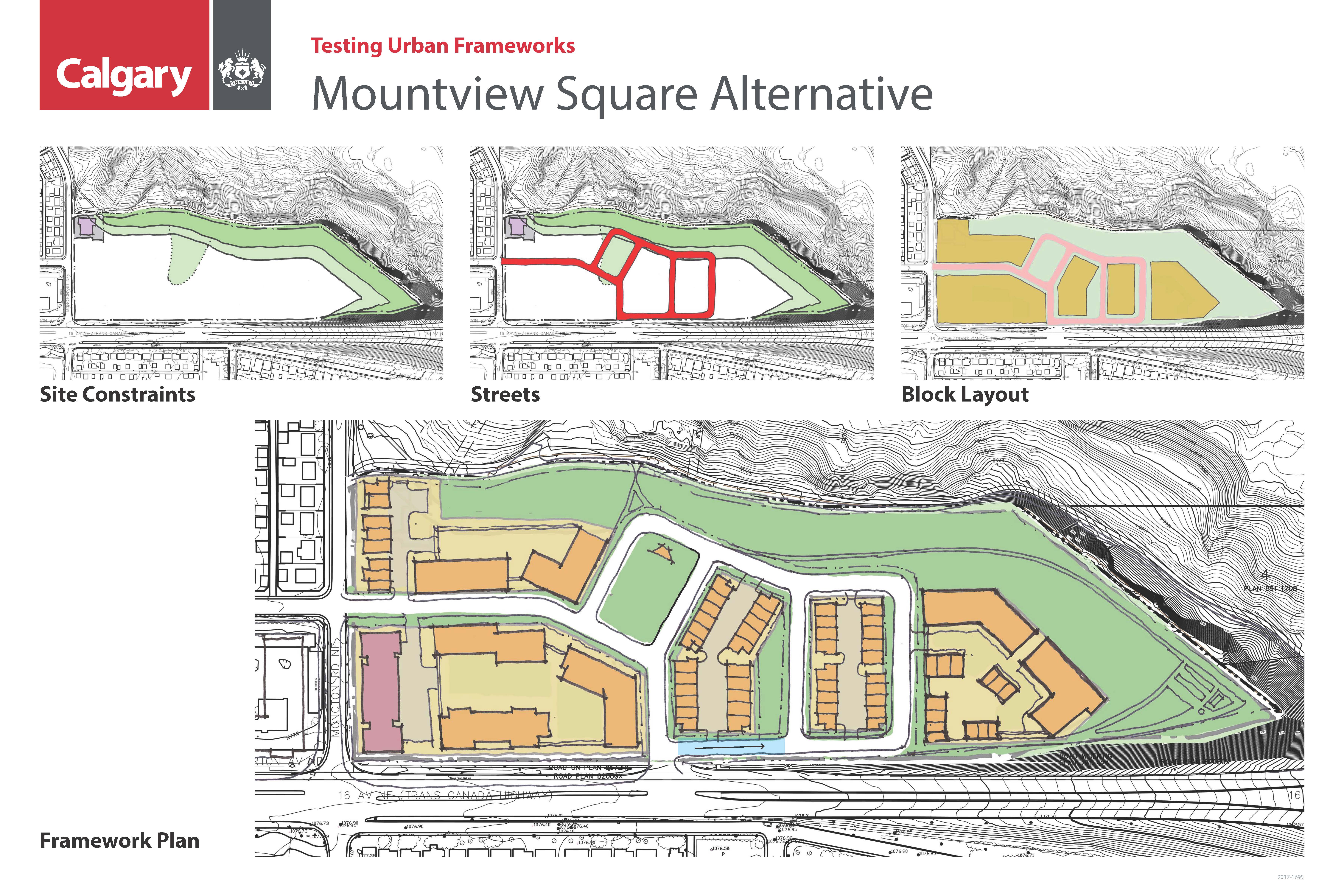
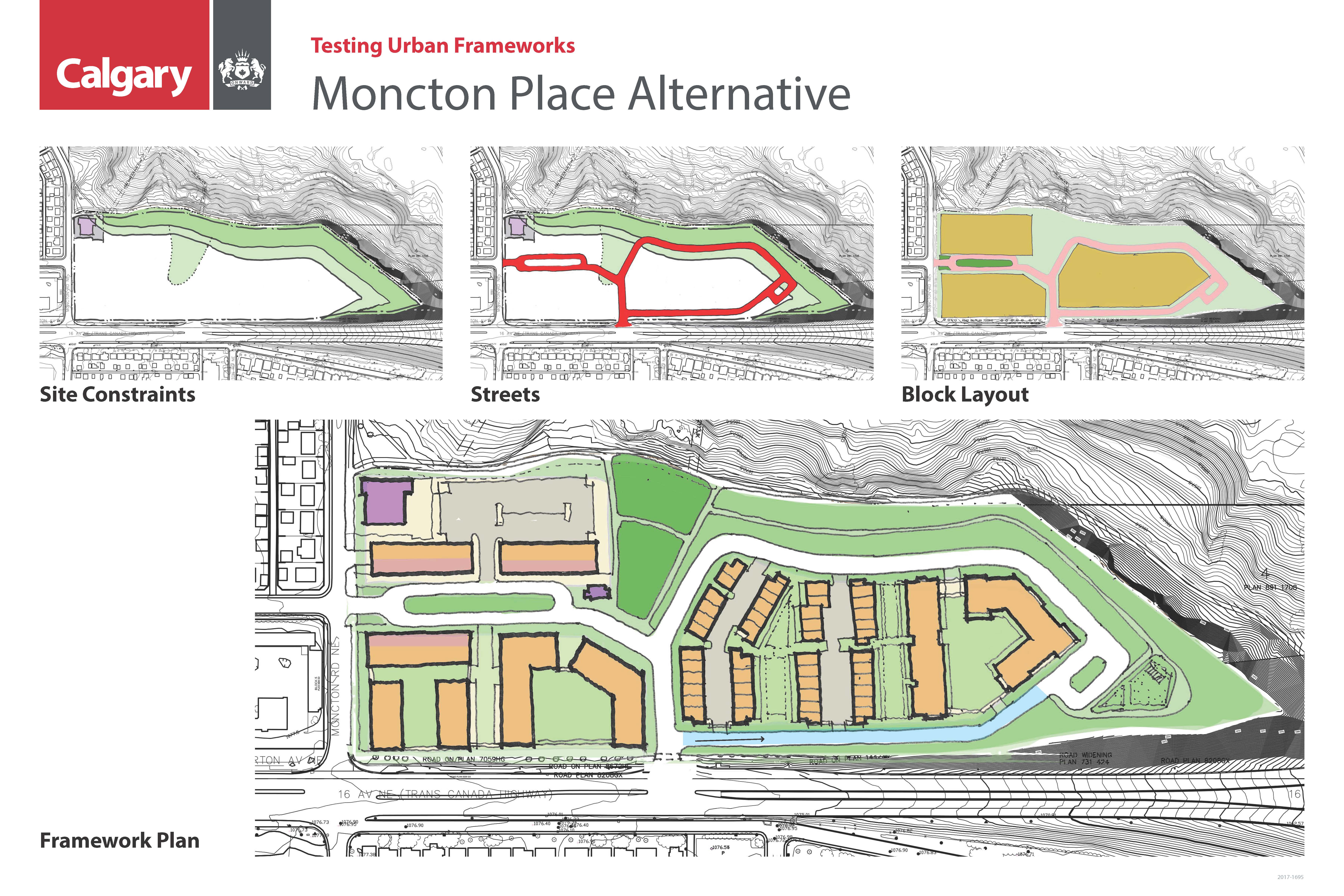
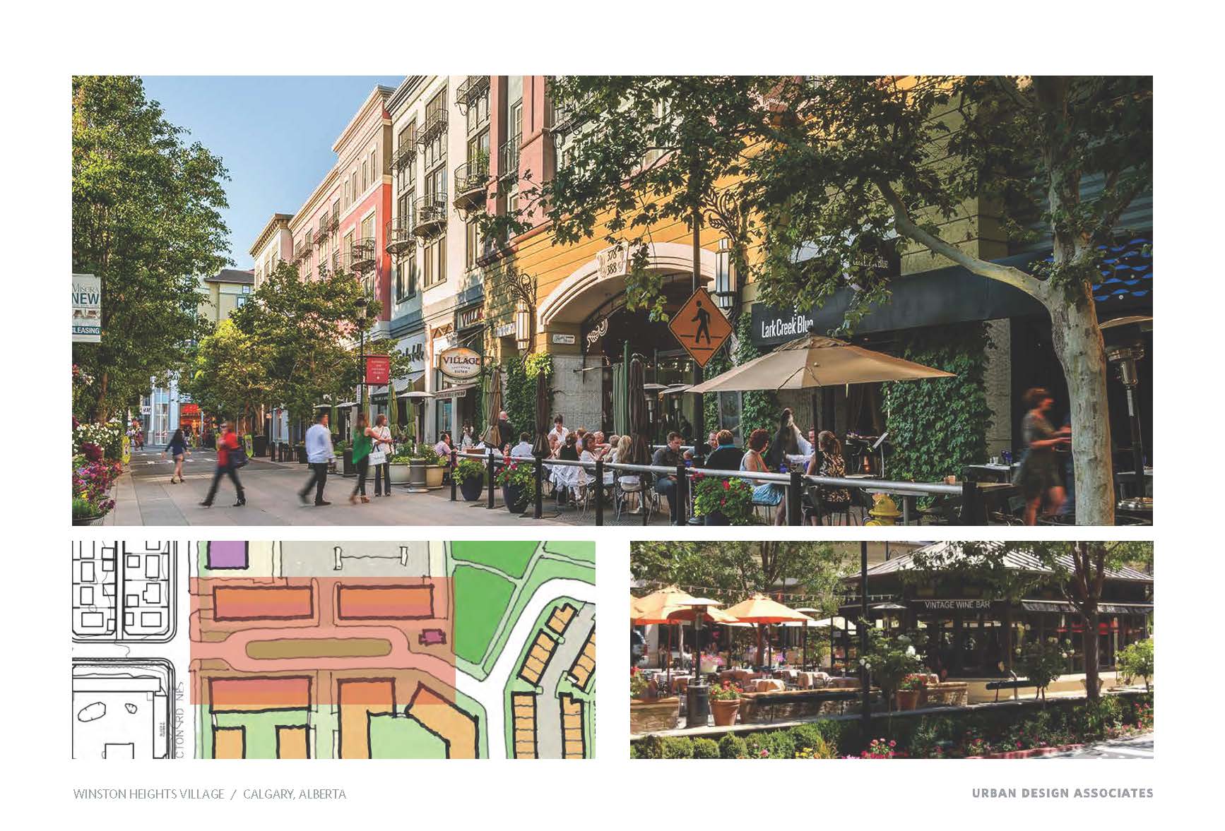
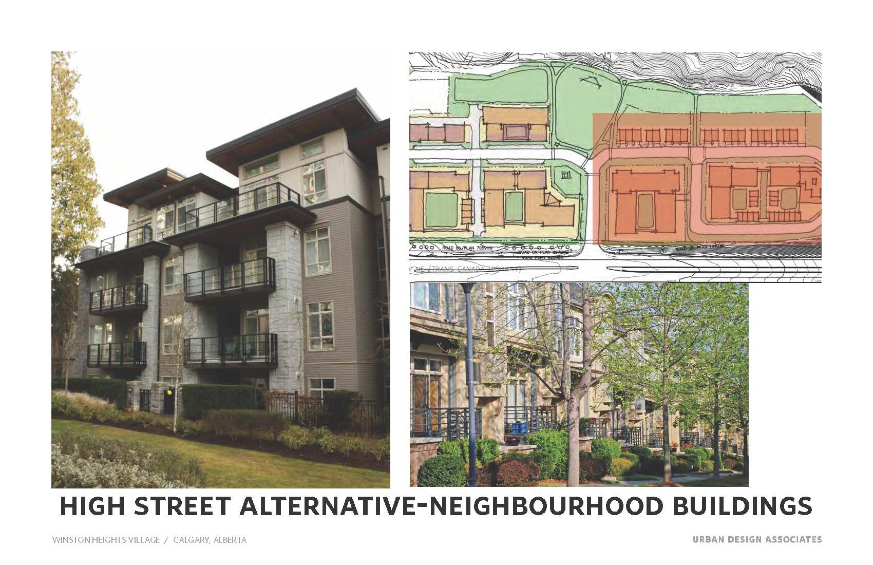
The following four images are the working concepts used for discussion purposes at the Thursday November 7, 2019 workshop. They do not represent final design concepts and were intended only as working models to generate feedback and ideas.
The information gathered at the November 4, 2019 and November 7, 2019 workshops was used by the project team to inform and refine a recommended concept plan. This version was presented at an open house and posted online for review and comment in December 2019.
The images below are the high level alternatives that were used to initiate discussion at the November 4, 2019 workshop. These alternatives were reviewed, discussed and refined through interactive conversations between the project team and the community.


The images below are strictly design concept options that are being used to create a most desirable options at the workshops. Work began with these at the workshop on Tuesday and we will be seeking further refinement at the session on Thursday Nov.7th. Following the sessions this week a refined single concept will be posted for further comment.


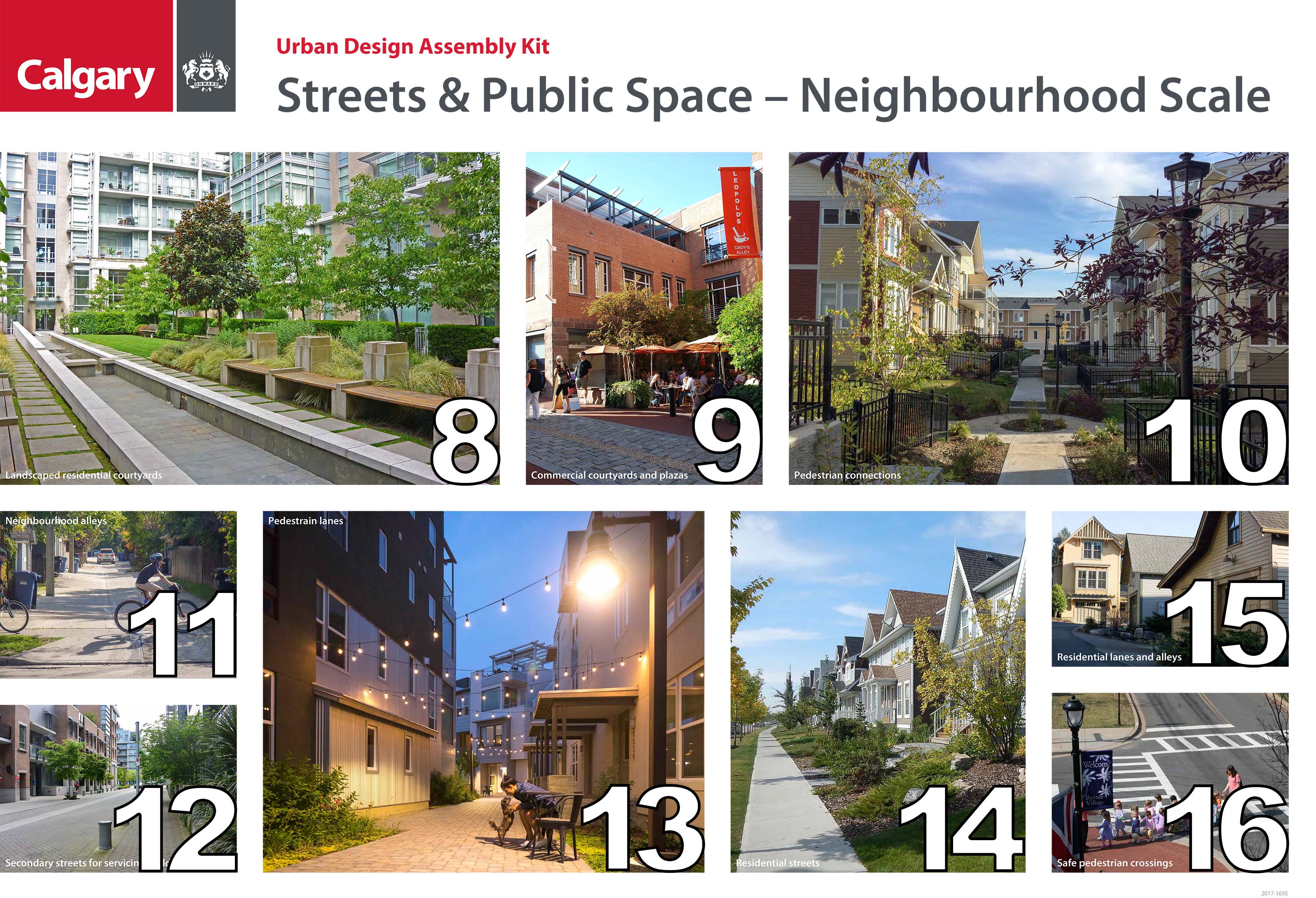
Streets and Public Space

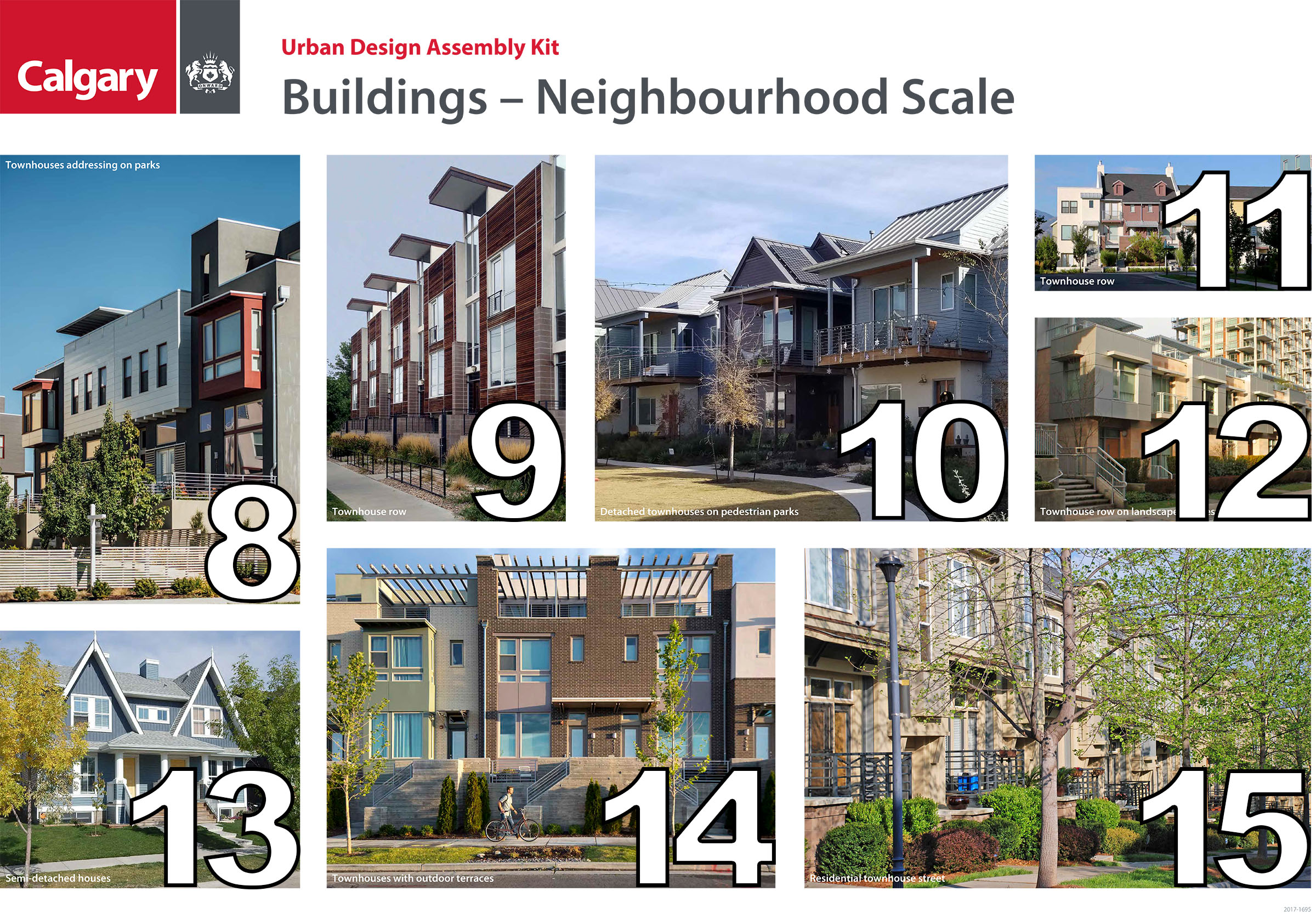
Buildings

Parks and Open Spaces


Phase 3 Engagement - Land Use Outline Plan
Please review the Final Project Information document by clicking here or view the multiple tabs below for a full recap of the project if needed prior to answering the questions.
You can click here to review the Phase 3 Guiding Principles Document for questions #1 & #2 below.
NEXT STEPS
PROJECT REDEVELOPMENT TIMELINE


