RoadNet
RoadNet is a single line graphical representation of the City of Calgary's roadways consisting of planned, unbuilt and built driveable surfaces such as:
RoadNet's segment feature attributes include graphical representation of Municipality, Street Name, Plan Number, Built Status, Road Class, Ownership, Address Ranges, Bridge and Exit information, etc.
Major RoadNet is a subset of the full RoadNet product containing information relating to major roads within Calgary, including secondary connectors .
Major Road Network product (showing only major roads in the City of Calgary) is available in our Open Data Catalogue as a free download.
User(s):
- Builders
- Developers
- Engineers
- Planners
Uses:
- Available in a cartographic and tabular format maintained by The City of Calgary on a daily basis, this data can be used to create customer accurate up-to-date road maps and map books.
- Base reference for many industries.
- Oil and gas as well as pipeline companies incorporate the RoadNet database into their GIS for emergency response mapping.
Benefits:
- Accurate – Updated nightly; shows tentative approved roads for planning purposes.
- Efficient – Licensing process completed in minutes rather than days; immediate download available.
- Versatile - Can be further customized to meet your needs by adding extra attribute features such as community and city limit boundaries, parks and rivers.
- Immediate download available from CITYonline.
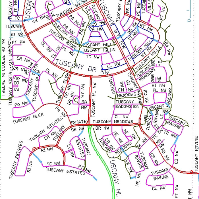
Example of Road Network (RoadNet) product
The Road Network (RoadNet) product is a database-driven, single line, graphical representation of the City of Calgary road network consisting of planned, unbuilt and built driveable surfaces.
The Road Network (RoadNet) product is a database-driven, single line, graphical representation of the City of Calgary road network consisting of planned, unbuilt and built driveable surfaces.