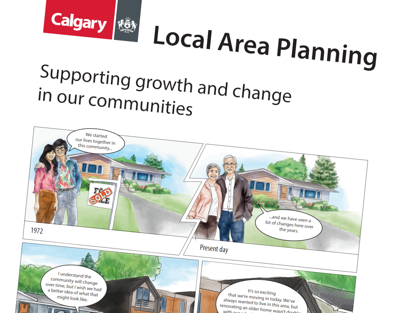
Resources and FAQs

Resources and FAQs
Maps - building types and size
There are two maps in a local area plan that show where buildings should go based on their use (urban form) and their size (building scale).
Map 1: Urban Form Map
The Urban Form Map shows types of buildings and what they should be used for. These can include primarily commercial/business areas, primarily residential areas and parks and open space.
- Detail the purpose and general function of different parts of the communities.
- Describe the mixture of different building types.
- Include supporting site and building design policies.
Map 2: Building Scale Map
The Building Scale Map shows the maximum height and size buildings can be in a specific area. Scale categories outline building heights and other design considerations such as step backs (where higher floors are set back from lower floors).
- Set the maximum potential height (in storeys) of buildings.
- Apply to the Neighbourhood and Vehicle - Oriented Commercial Categories only (e.g. Parks, Civic and Recreation and Industrial categories do not include an associated scale).
Learn about the different urban forms and building scales and what each colour represents. Toggle to the left/right to view each map. For discussion purposes only.
Map 1: Urban Form Map
Map 2: Building Scale Map
Download the Urban Form and Building Scale Overview.
Videos
Want to learn more about local area planning? Check out these videos.
Other resources
The Guide for Local Area Planning provides information, policies, and tools for developing local area plans. It provides a common language for discussing and planning for growth and change.
There are key steps and stages as cities and communities are planned, and as new homes and businesses are proposed and built. Learn more and get involved. Get Involved in Shaping Our City and Communities
Land is not rezoned if/when a local area plan is approved. If/when there is interest in rezoning land, it goes through a separate review and decision-making process. Learn more about this process below. Land Use Rezoning Illustration
Frequently asked questions
Why are local area plans needed?
Local area plans provide guidance and direction as new communities are being built. They also guide communities when they reach their natural redevelopment life cycle stage.
A local area plan is helpful when a neighbourhood naturally starts revitalization and redevelopment. A local area plan encapsulates a future vision for the area. It provides development direction that residents, landowners, builders/developers, City Planners, and Councillors can refer to. This guidance is useful as new development ideas are proposed for the area.
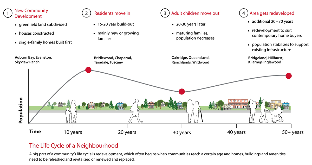
Citywide, we need to consider where and how growth and redevelopment should happen.
We need to consider:
- Changing housing needs and preferences
- Sustainability and urban footprint of our city
- Balancing costs of new and maintaining existing infrastructure, amenities, and facilities to support both new and established communities.
- Balancing population across both new and established communities to support local schools, facilities, and businesses.
The City is responsible for managing growth and development across Calgary and looks at how and where growth should happen. Growth and development are encouraged in key areas. There is a city-wide plan for growth to be distributed between developed and new communities. Learn more about Calgary’s Municipal Development Plan.
Why are communities grouped together?
When looking at the best way to create and update local area plans on an ongoing basis, creating local area plans based solely on community boundaries is not sustainable. There are simply too many communities.
In our city, there are shared amenities like local businesses, transit stations, recreation facilities and schools, that connect communities together. However, physical boundaries like major roads, rivers and large natural areas naturally separate us. Our daily experiences are not confined to our immediate community. For example, you might visit a neighbouring community to buy groceries, or take yoga classes. You could also travel through multiple communities walking your dog, to get to work, or dine at a restaurant.
Grouping communities by boundaries and shared amenities enables collective planning and discussion. This is the basis behind the concept of The City's local area plans.
Local area planning has the following benefits:
- Creates stronger linkages between communities and to key amenities and infrastructure.
- Allows for better identification of common issues, opportunities and solutions.
- Facilitates holistic discussions on new growth across larger areas.
- Includes a broader citizen and partner perspective in each plan.
- Allows for more effective engagement and plan development. This is essential toward replacing obsolete plans with modern planning tools.
- Fewer plans allow for more frequent and consistent updates to address current conditions.
How are local area plan boundaries determined?
Local plan areas use major roads (such as Crowchild Trail, Deerfoot Trail, Anderson Trail, McKnight Boulevard, Shaganappi Trail) and geographic features (rivers, major parks such as Nose Hill, Confederation or Fish Creek parks) as they create more physical boundaries to define city regions. These features are easily identifiable on a map and shape our daily lives. Holistic planning integrates existing amenities with new development and investment.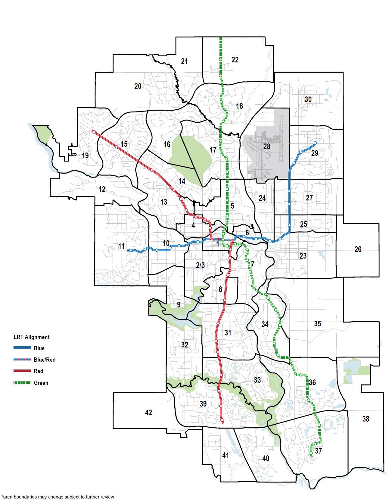
View larger map
While some boundaries, like Deerfoot Trail, are obvious, others are not. Some communities or parts of communities may fit equally well into one neighbouring plan area or another. Ultimately, each community will be part of a local area plan with neighbouring communities.
Does being in the same local area plan mean that communities will be treated the same in these areas?
No. Being in the same city or local area plan doesn’t mean all communities are treated the same. Geography, infrastructure requirements, mobility networks, community layout, history, and market will continue to shape each community’s path. Local area planning processes will consider these factors. Each community and local plan area has unique characteristics which shape their roles.
What is the Guide for Local Area Planning and how does it relate to local area plans?
The Guide for Local Area Planning provides information, policies, and tools for developing local area plans. It provides a common language for discussing and planning for growth and change.
Can local area plans be amended?
Local area plans are meant to be living documents which can be amended and updated over time. This allows them to adapt as the community evolves and conditions change.
City Council is the decision maker for all amendments to a local area plan.
How is participant input considered in the creation of a local area plan?
Input from community members and partners helps the project team understand perspectives, opinions and concerns throughout project phases. Input from each project phase helps shape and refines concepts and policies. The project team shares what was heard, highlights key themes, and explains how they will be addressed.
The goal of public engagement isn’t to reach consensus or make everyone happy. Public engagement considers input from those affected before making decisions. Public input is an important part of local area planning, but is one of many areas of consideration. Other areas include: City policies, professional expertise, context, trends, and equity. All of which factor into the ultimate decision-making process and concept development.